
p-banners
Highlights
- An advanced stage, 100% controlled copper project in Arizona
- Over 50,000m of historical drilling has been completed within the district, with near surface mineralization of copper, silver, zinc and gold
- Located in a historical mining camp
- Phase 1 (2024) drilling validated the potential of Corral
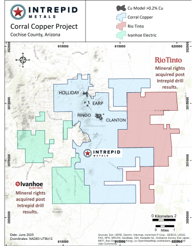
- Following the 2024 program, two majors (Rio Tinto and Ivanhoe Electric) acquired mineral rights immediately adjacent
- Phase 2 (2025) drilling expanded and confirmed the potential with almost 5,500m of drilling
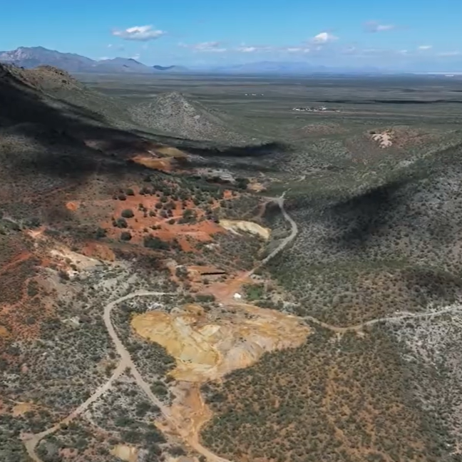
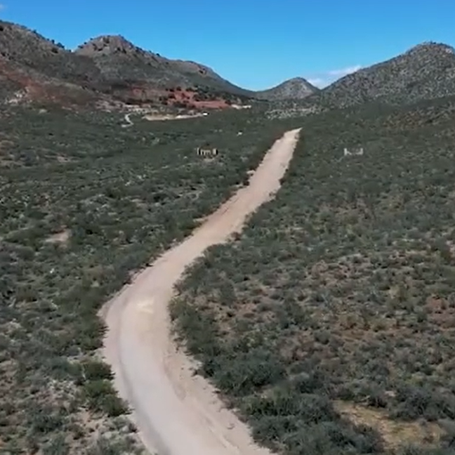
- Robust land package of roughly 10,346 acres (4,187 hectares) of mineral rights including over 2,000 acres of Patented mining claims and surface rights
- 3.5km trend of shallow mineralization and remains open in all directions
- Source of mineralization yet to be discovered
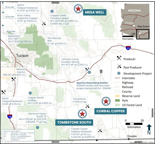
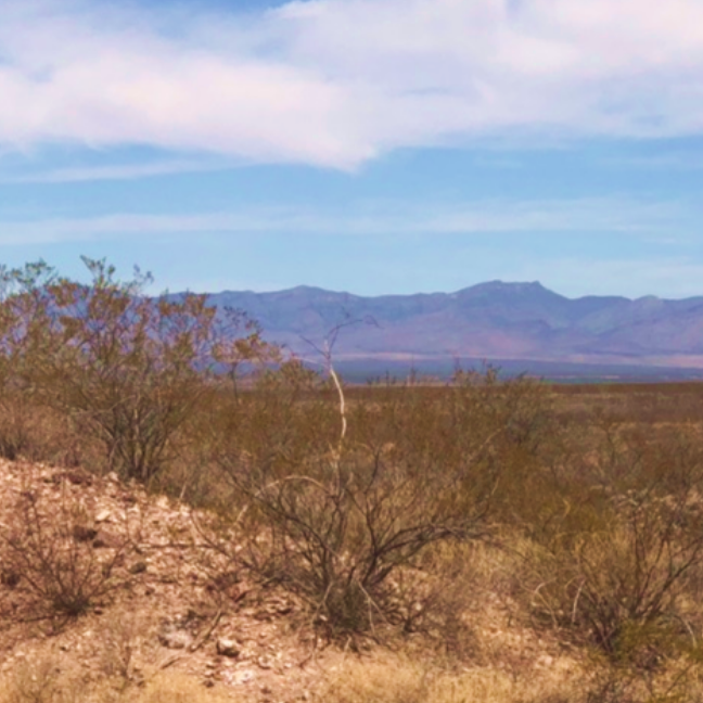
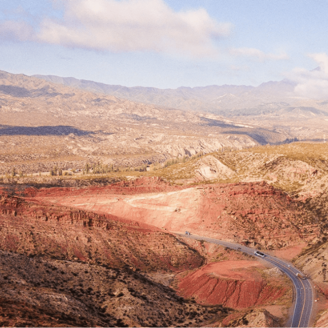
Ideally Located
- The Corral Copper Project is located in Cochise County, Arizona, 15 miles east of the famous mining town of Tombstone and 22 miles north of the historical Bisbee mining camp which has produced more than 8 billion pounds of copper with grades of up to 23%. Production from the Bisbee mining camp is not necessarily indicative of the mineral potential at the Corral Copper Project.
- Corral Copper consists of roughly 10,346 acres (4,187 hectares) of mineral rights including over 2,000 acres of Patented mining claims and surface rights.

Mining History
- The district has a mining history dating back to the late 1800s, with several small mines extracting copper from the area in the early 1900s, producing several thousand tons with grades up to 9.2% copper ore. Between 1950 and 2008, various companies explored parts of the district, but the effort was uncoordinated, non-synergistic and focused on discrete land positions and commodities due to the fragmented ownership. Intrepid has been able to secure data from various sources which provides a solid foundation in creating geological interpretations and identifying new target areas.
-
Over 50,000m of historical drilling has been completed within the district, with several significant near surface drill intercepts. Intrepid considers these historical drill results relevant, as the Company is using this data as a guide to plan current and future exploration programs.
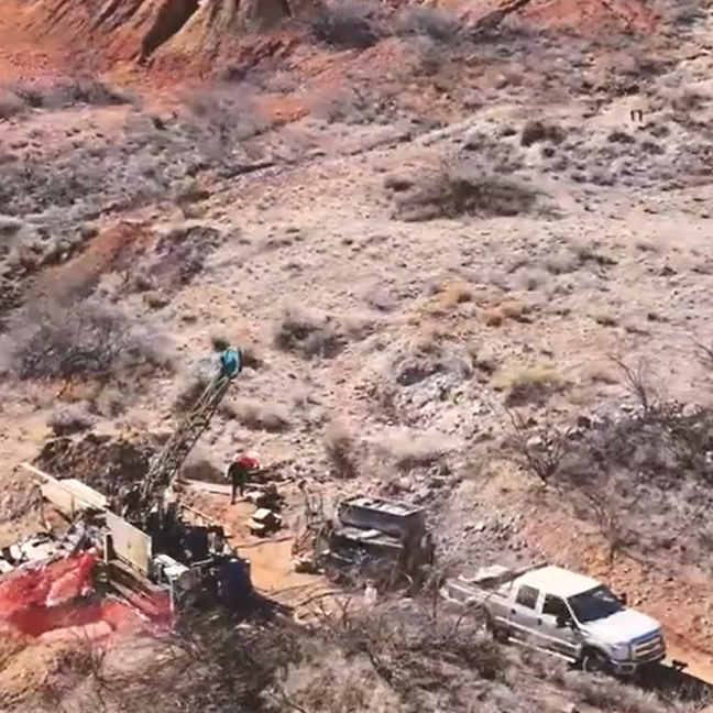
2024 Drill Program
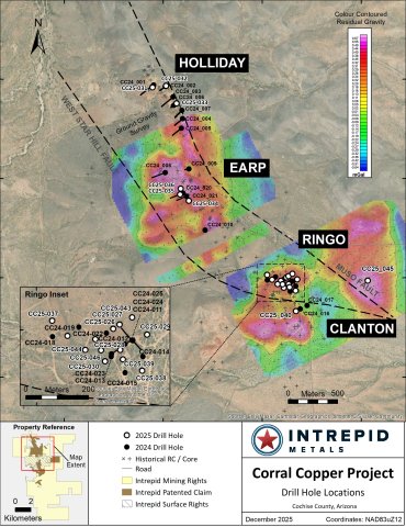
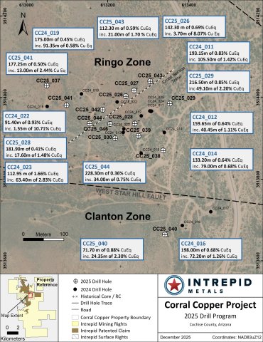
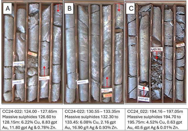
Intrepid completed an initial 5,000 meter Phase 1 diamond drill program within a 3.5 kilometer trend of near surface, locally high-grade copper-gold-silver-zinc mineralizaiton. A total of 25 diamond drill holes were completed within the private lands including 2960m at the Ringo Zone, 736m at the Earp Zone and 1110m at the Holliday Zone.
Drill results confirmed the 3.5-kilometer long trend of near surface carbonate replacement ("CRD") and related supergene enrichment oxide copper-gold-silver-zinc mineralization in the Holliday, Earp and Ringo zones. Highlights include:
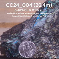
- 112.95 meters (“m”) of 1.50% Copper (“Cu”), 0.53 grams per ton (“gpt”) Gold (“Au”) and 8.22 gpt Silver ("Ag") (1.66% Copper Equivalent (“CuEq”)1) from 68.40 to 181.35m in Hole CC24_023 including,
- 63.40m of 2.57% Cu, 0.91 gpt Au and 14.14 gpt Ag (2.83% CuEq1)
- 13.40m of 6.72% Cu, 1.49 gpt Au and 46.93 gpt Ag (6.90% CuEq1) and
- 1.40m of 20.20% Cu, 8.51 gpt Au and 250.00 gpt Ag (23.85% CuEq1).
- 193.15m of 0.68% Cu and 0.33 gpt Au (0.83% CuEq1 from 27.00 to 220.15m in Hole CC24_011 including,
- 105.20m of 1.17% Cu and 0.55 gpt Au (1.42% CuEq1)
- 48.85m of 2.24% Cu and 0.97 gpt Au (2.58% CuEq1) and
- 3.90m of 6.80% Cu and 1.02 gpt Au (6.54% CuEq1).
- 198.00m of 0.56% Cu, 0.12 gpt Au and 4.35 gpt Ag (0.68% CuEq1) from 10.00 to 208.00m in Hole CC24_016 including,
- 72.20m of 1.28% Cu, 0.08 gpt Au and 3.16 gpt Ag (1.26% CuEq1) and
- 1.60m of 5.30% Cu, 1.95 gpt Au and 11.20 gpt Ag (5.72% CuEq1).
- 124.00m of 0.52% Cu and 0.35 gpt Au (0.73% CuEq1) from 10.00 to 134.00m in Hole CC24_001 including,
- 100.35m of 0.57% Cu and 0.41 gpt Au (0.81% CuEq1) and
- 4.00m of 2.70% Cu and 0.89 gpt Au (3.06% CuEq1).
- 159.65m of 0.57% Cu and 0.22 gpt Au (0.64% CuEq1) from 28.35 to 188.00m in Hole CC24_012 including,
- 40.45m of 0.97% Cu and 0.40 gpt Au (1.11% CuEq1) and
- 3.85m of 3.34% Cu and 1.54 gpt Au (3.86% CuEq1).
Notes:
1 Composite intervals are calculated using length weighted averages based on a combination of lithological breaks and copper, gold, silver and zinc assay values. All intervals reported are core lengths, and true thicknesses are yet to be determined. Mineral resource modeling is required before true thicknesses can be estimated. Analyzed Grade corresponds composite weighted (“composites”) averages of laboratory. Metal Equivalent corresponds to undiluted metal equivalent of reported composites and Diluted Metal Equivalent takes into account dilution factors of 85% for Copper, and 80% for gold, silver and zinc for reported composites. Metal prices used for the CuEq and AuEQ calculations are in USD based on Ag $22.00/oz, Au $1900/oz, Cu $3.80/lb, Zn $1.15/lb The following equation was used to calculate copper equivalence: CuEq = Copper (%) (85% rec.) + (Gold (g/t) x 0.71)(80% rec.) + (Silver (g/t) x 0.0077)(80% rec.) + (Zinc (%) x 0.28)(80% rec.). The following equation was used to calculate gold equivalence: AuEq = Gold (g/t)(80% rec.) + (Copper (%) x 1.4085)(85% rec.) + (Silver (g/t) x 0.0108)(80% rec.) + (Zinc (%) x 0.4188)(80% rec.). Analyzed metal equivalent calculations are reported for illustrative purposes only. The metal chosen for reporting on an equivalent basis is the one that contributes the most dollar value after accounting for assumed recoveries.
2025 Drill Program
Phase 2 Drill Program
The 5,765 meter, Phase 2 drill program is complete and included 21 diamond drill holes at the Ringo, Earp, Holliday and newly outlined Clanton Zones.
Highlights from 2025 inlcude:
- 142.30 meters ("m") of 0.51% Copper ("Cu"), 0.17 grams per ton ("gpt") Gold ("Au") and 4.01 gpt Silver ("Ag") (0.69% Copper Equivalent ("CuEq")1) from CC25_26 including,
- 84.90m of 0.79% Cu, 0.26 gpt Au and 6.18 gpt Ag (1.06% CuEq1) and
- 17.65m of 2.72% Cu, 0.58 gpt Au and 18.16 gpt Ag (3.30% CuEq1) and
- 0.55m of 27.50% Cu, 10.15 gpt Au and 192 gpt Ag (36.54 CuEq1).
- 216.50m of 0.71% Cu, 0.28 gpt Au and 5.14 gpt Ag (0.85% CuEq1) from CC25_29 including,
- 49.10m of 1.84% Cu, 0.78 gpt Au and 11.41 gpt Ag (2.20% CuEq1) and
- 10.25m of 5.94% Cu, 2.20 gpt Au and 25.50 gpt Ag (6.51 CuEq1).
- 140.80m of 0.27% Cu, 0.15 gpt Au and 3.37 gpt Ag (0.36% CuEq1) from CC25_37 including,
- 32.15m of 0.66% Cu, 0.29 gpt Au and 9.87 gpt Ag (0.85% CuEq1) and
- 13.30m of 0.94% Cu, 0.40 gpt Au and 10.31 gpt Ag (1.15 CuEq1).
- 177.25m of 0.41% Cu, 0.19 gpt Au and 2.52 gpt Ag (0.58% CuEq1) from CC25_41 including,
- 13.00m of 2.20% Cu, 0.84 gpt Au and 4.46 gpt Ag (2.76% CuEq1).
Confirmed Porphyry Copper-Gold Potential at Corral Copper
Carbonate replacement ("CRD") style copper-gold-silver-zinc mineralization is the dominant form of mineralization across the Ringo, Earp and Holliday zones at Corral. The Intrepid technical team has recognized porphyry-style alteration and mineralization features internal to this broad CRD footprint including porphyry veins (quartz-magnetite veins, porphyry D-Veins, A-Veins and B-Veins) and high-temperature potassic alteration (potassium feldspar vein selvages and secondary biotite) and hydrothermal breccias. These higher temperature domains indicate that CRD mineralization is locally transitional to porphyry copper styles, demonstrating that the Corral Copper Property has potential for previously unrecognized bulk-tonnage porphyry copper-gold discoveries. This is significant because the directly analogous Bisbee Mining Camp contains similar host rocks, alteration styles as well as genetically and spatially linked CRD (historic production from Copper Queen; 53Mt @ 6% Copper4) and porphyry (historic production from Lavender Pit; 223Mt at 0.63% Cu4) deposits. Ongoing exploration at Corral, including diamond drilling, surface mapping, sampling, and prospecting coupled with various (new ground gravity) and historical geophysics (airborne ZTEM, VTEM and magnetic surveys) has identified several magmatic-hydrothermal centers on the Property. All of these new targets have previously unrecognized potential to host porphyry copper-gold mineralization and represent significant upside exploration potential for the project.
Emerging Gold Mineralization
The Corral Copper Project and the Bisbee Mining Camp ("Bisbee") (Copper Queen CRD Deposit, 53 M tonnes ('t") at 6% Cu and the spatially and genetically linked Lavender Pit Porphry Deposit with 223Mt at 0.63% Cu2) occur in similar geological settings and therefore share many features in common including favourable host rocks (Jurassic intrusions and Paleozoic and Cambrian carbonates sedimentary host rocks), alteration styles (decalcification, marbelization, calcsilicate/skarn, quartz-sericite-pyrite and potassic) and timing of mineralization (Jurassic). Both Corral and Bisbee are also gold enriched (Copper Queen produced approximately 2.8M ounces of gold and 77M ounces of silver, making it the largest gold producer in Arizona2) which is a feature that is not present in all CRD/Porphyry deposits globally. Intrepid has recognized and prioritized the contribution of gold mineralization to the upside exploration potential of the project and has been working to further it's understanding of the distribution of gold at Corral. Intrepid identified a series of important syn- to post-mineral breccias that occur internal to Ringo, Earp and Holliday but also in many other parts of the Property (emerging targets) which have the potential to contribute significant volumes of gold mineralization and represent a focus for future exploration drilling on the Property.
Gold Highlights from Intrepid's 2024 and 2025 drill program:
-
105.20m of 0.55 gpt Au including 48.85m of 0.97 gpt Au in Hole CC24_011
-
44.40m of 0.53 gpt Au including 3.30m of 1.86 gpt Au in Hole CC24_013
-
79.00m of 0.65 gpt Au including 33.00m of 1.43 gpt Au and 2.35m of 15.84 gpt Au in Hole CC24_014
-
112.95m of 0.53 gpt Au including 63.40m of 0.91 gpt Au in Hole CC24_023
-
49.10m of 0.78 gpt Au including 23.05m of 1.31 gpt Au in Hole CC25_029
-
37.50m of 1.00 gpt Au in Hole CC25_030
Notes:
1 Composite intervals are calculated using length weighted averages based on a combination of lithological breaks and copper, gold, silver and zinc assay values. All intervals reported are core lengths, and true thicknesses are yet to be determined. Mineral resource modeling is required before true thicknesses can be estimated. Analyzed Grade corresponds composite weighted ("composites") averages of laboratory analyses. Metal Equivalent corresponds to undiluted metal equivalent of reported composites and Diluted Metal Equivalent takes into account estimated recovery of 85% for copper, and 80% for gold, silver and zinc for reported composites. Metal prices used for the CuEq and AuEQ calculations are in USD based on Ag $22.00/oz, Au $1900/oz, Cu $3.80/lb, Zn $1.15/lb The following equation was used to calculate copper equivalence: CuEq = Copper (%) (85% rec.) + (Gold (g/t) x 0.729150601917791)(80% rec.) + (Silver (g/t) x 0.00844279644325863)(80% rec.) + (Zinc (%) x 0.302631578947368)(80% rec.). The following equation was used to calculate gold equivalence: AuEq = Gold (gpt)(80% rec.) + (Copper (%) x 1.3714285702785)(85% rec.) + (Silver (gpt) x 0.0115789473684211)(80% rec.) + (Zinc (%) x 0.415037593636916)(80% rec.). Analyzed metal equivalent calculations are reported for illustrative purposes only. The metal chosen for reporting on an equivalent basis is the one that contributes the most dollar value after accounting for assumed recoveries.
2 Briggs, D.F., 2015, History of the Warren (Bisbee) Mining District, Arizona Geological Survey Contributed Report CR15b,8 p.
3 Lewis, K., 2022, Geology and Mineralization of the Undeveloped Cochise Supergene Porphyry Copper Deposit, Warren (Bisbee) Mining District, Cochise County, Arizona, The University of Arizona, MSc thesis, 104 pages.
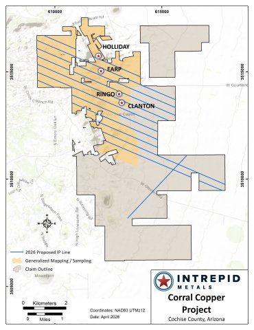
2026 Program
Phase 1 of the 2026 Exploration Program includes detailed geological mapping, a comprehensive geochemical campaign (grid rock sampling including more than 450 rock samples), and an expanded electromagnetic geophysical surveying totaling approximately 65-line kilometres of induced polarization (“IP”) and magnetotellurics (“MT”), designed specifically to resolve subsurface geological features attributable to porphyry- and CRD-style mineralization. In addition, a passive seismic geophysical survey will be conducted to help constrain depth to bedrock in covered portions of the Property.
This work will support a substantial Phase 2 diamond drilling program in Q3/Q4 2026, expected to comprise a combination of deeper holes targeting porphyry mineralization and shallower drilling designed to delineate additional zones of CRD mineralization identified in previous exploration campaigns.
Technical Information
All scientific and technical information on this webpage has been prepared by, or approved by Daniel MacNeil, PGeo. Mr. MacNeil is a Technical Advisor to the Company and is a qualified person for the purposes of National Instrument 43-101 - Standards of Disclosure for Mineral Projects.
Mr. MacNeil has verified the drilling data disclosed on this webpage, including the assay and test data underlying the information or opinions contained on this webpage. Mr. MacNeil verified the data disclosed (or underlying the information disclosed) by reviewing imported and sorted assay data; checking the performance of blank samples and certified reference materials; reviewing the variance in field duplicate results; and reviewing grade calculation formulas. Mr. MacNeil detected no significant QA/QC issues during review of the data and is not aware of any sampling, recovery or other factors that could materially affect the accuracy or reliability of the drilling data referred to on this webpage.
However, some of the data disclosed is related to historical drilling results which have been identified as such. Intrepid Metals and Mr. MacNeil have not undertaken any independent investigation of the sampling nor have they independently analyzed the results of the historical exploration work in order to verify the results. Intrepid and Mr. MacNeil considers these historical drill results relevant as the Company is using this data as a guide to plan exploration programs. The Company's current and future exploration work includes verification of the historical data through drilling.
Quality Assurance and Quality Control
Drill core was first reviewed by a geologist, who identified and marked intervals for sampling. The marked sample intervals were then cut in half with a diamond saw; half of the core was left in the core box and the other half was removed, placed in plastic bags, sealed and labeled. Intervals and unique sample numbers are recorded on the drill logs and the samples are sequenced with standards and blanks inserted according to a predefined QA/QC procedure. The samples are maintained under security on site until they are shipped to the analytical lab.
All core samples were sent to ALS Geochemistry (ALS), a division of ALS Global, in Tucson, Arizona, for sample preparation, with pulps sent to the ALS Geochemistry laboratory in Reno, Nevada for analysis. ALS meets all requirements of International Standards ISO/IEC 17025:2017 and ISO 9001:2015 for analytical procedures and is independent of the Company. HQ size core was split and sampled over approximately two metre intervals. Samples were analyzed using: ALS’s Fire Assay Fusion method (Au-AA23) with an AA finish for gold and by gravimetric finish (Au-GRA21) for samples assaying greater than 10 ppm (g/t) gold; by a 36-element four acid digest ICP-AES analysis (ME-ICP61) with additional analysis for Ore Grade Cu (Cu-OG62), Ore Grade Zn (Zn-OG62) and Ore Grade Pb (Pb-OG62); and for silver assays above 100 ppm (g/t) by Fire Assay Fusion method with gravimetric finish (Ag-GRA21). ME-ICP61 results were reported in parts per million (ppm), Ore Grade (OG62) results were reported in percent (%). In addition to ALS quality assurance- quality control (QA/QC) protocols, Intrepid implements an internal QA/QC program that includes the insertion of sample blanks, duplicates, and standards, with QA QC control samples comprising approximately 10% of the sample stream.
Maps and Sections
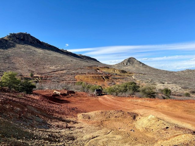
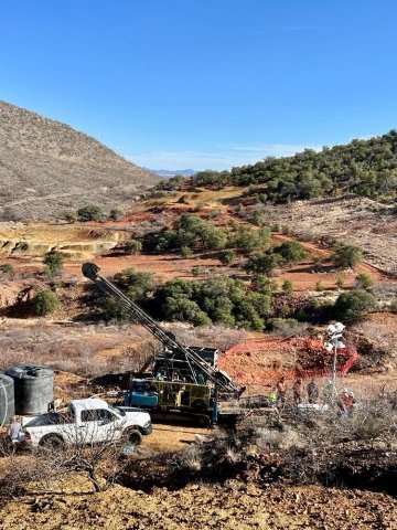
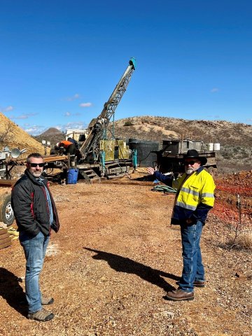
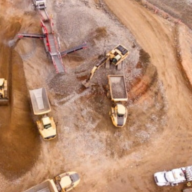
Gallery
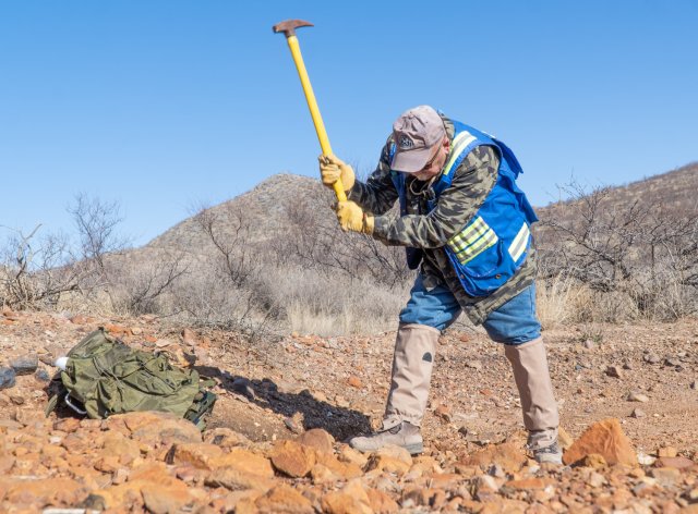
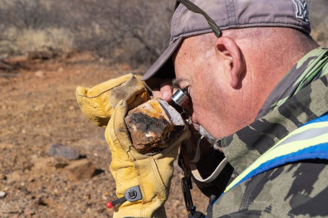
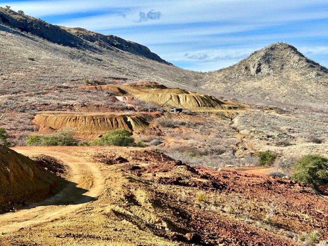
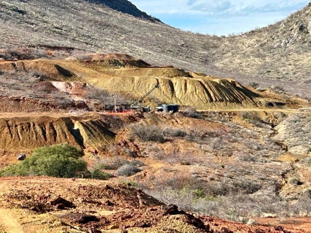
Photos
Videos
Complete Corral 2026 Site Visit
Corral 2026 Site Visit Part 1: Corral Infrastructure
Corral 2026 Site Visit Part 2: What the Core Tells Us
Corral 2026 Site Visit Part 3: Revisiting the Past
Corral 2026 Site Visit Part 4: Bisbee Analog
2024 Core Photos (Holes 1-11)
Corral Copper Site Visit April 2024